This repo powers roadway.report, a web application in-development which will serve data on any traffic death in the USA since 1975.
I want people to build nice, interactive maps ontop of these APIS. This can support a nationwide vision-zero viewer.
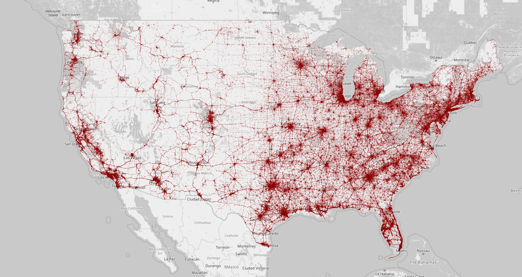
Here's a crummy proof of concept.
Or get data straight from the API via the docs and TUTORIAL.
The data was interpreted mostly from this manual, published by the NHTSA.
Based on this original data model:

The data is now represented by a much more modern and descriptive schema.
In the file data_dictionary.py, you can find a complete mapping of the government table/variable names to the more descriptive variable names used on roadway.report
Sorry folks, no docker here, but dependencies are pretty minimal. This is literally every command I had to run on a fresh install of debian to get this sucker up on my non-work machine.
sudo apt update
sudo apt install git
sudo apt install pip
sudo apt install postgresql-14
sudo apt install postgresql-14-postgis-3
Pop open postgres:
sudo -u postgres psqlAnd let's make a database:
CREATE DATABASE crash;
\c crash;
CREATE EXTENSION postgis;
CREATE USER app WITH PASSWORD 'assword';
GRANT ALL PRIVILEGES ON DATABASE crash TO app;
Clone the repo:
cd /path/to/where-you-want-the-application
git clone https://github.com/bencarneiro/ntsb.git
Get your python packages sorted:
(Feel free to create a virtual environment here.)
pip install django
pip install pandas
pip install pymysql
pip install django-extensions
pip install psycopg
pip install django-ninja
pip install folium
pip install geoip2
pip install googlemaps
pip install pillow
pip install qrcode
Geo location: Application uses IP addresses to find user-location and load the map.(Django docs on how this is set up). Download the geographies and then then make sure they line up with the GEOIP_PATH in settings.py This doesn't really work in development anyway (you make requests both to-and-from 127.0.0.1) so the Geolocation from IP is bunk in dev.
Next, let's rip in some data, shall we? download this db dump, which contains a real copy of production (1.7 GB):
sudo -u postgres psql crash < db_backup_2025_07_02.sqlThen give it a boot:
python3 manage.py runserverThen boot up the tile server:
cd fatalities/templates/static/tiles
http-server . --cors
and then try to access your server at http://127.0.0.1:8000.
Feel free to reach out if something goes wrong ben@bencarneiro.com